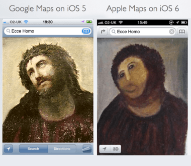
So what are the alternative maps solutions to make maps on iOS 6 useful again? Fortunately, the app ecosystem can provide plenty of alternatives, but if you’re missing Google Maps, there are other ways to get it back as well.
Bookmark Google Maps and Add it to Your Home Screen Open mobile Safari and navigate to maps.google.com. When the page loads, it prompts you to add the site as a bookmark on your home screen. Presto, you have Google Maps back and it’s easily accessible. Sure, its the web version, but it will give you back some of the functionality and detail that you missed before such as public transportation guides.
Add Nokia Maps to Your Home Screen Much the same as above, except it’s from maps.nokia.com. Routing, directions for walking, and public transportation guides are available here too.
Waze If you’re a driver you can download Waze. Waze provides turn by turn directions, voice guided navigation, traffic reports, speed cameras and gas prices. Plus the app is free. One of the more popular apps around at the moment.
Garmin StreetPilot on Demand It’s Garmin and they’ve been in the navigation business for a long time. This map also provides turn by turn voice navigation, shows you speed limits and you can even create entire trip plans. It also shows 3D buildings, navigation for walking and public transportation guides. Some of the features require you to purchase a subscription.
Motion X GPS Drive You can pre load maps for offline use with this app, a very useful feature if you intend on going somewhere where data connectivity is poor. It shows local speed limits, predictive traffic routing, visual lane assistance as well as pedestrian navigation. Turn by turn navigation requires a monthly subscription.
vTransit For anyone who is travelling by public transportation, this app wil help you plan your journey whether it is by bus, train or ferry. It fills in one of the missing features in this first iOS 6 release which is the lack of public transportation routing.
MapQuest A free app that provides voice guided, turn by turn navigation. It also provides gas prices and live traffic cameras so that you can take a peek at the traffic further ahead if you’re stuck in a jam.
Lumatic City Maps This is another app for public transportation and walking. It covers 27 major metropolitan areas in the USA and provides details of scheduled departure times. Best to check if this app covers your city first.
Maps+ This app uses Google Maps and allows you to create location based alarms and record your GPS tracks. It also one of the few apps that provides directions for cyclists.
Co-Rider A mapping app built specifically for the cyclists, the routing is tailored for bikes and will guide cyclists down bike paths, avoiding unsuitable roads. This app uses OpenStreetMap data. If you have a favorite alternative mapping app, let us know in the comments or on Facebook / Twitter. Photo credit: fedorientamento via flickr (CC BY 2.0)

